Mykolaiv (Mykolayiv)
 |
 |
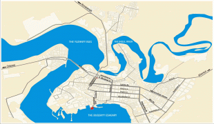
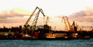
The city serves as a transportation hub for Ukraine, containing a sea port, commercial port, river port, highway, railway junction, and airport.
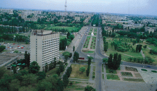
Much of Mykolaiv's land area consists of parks. Park Peremohy (Victory) is a large park on the peninsula just north of the city center of Mykolaiv, on the north side of the Inhul river.
The city is known under two names, which differ in Ukrainian and Russian; there are several transliterations of each name. The Ukrainian name of the city is Микола́їв, transliterated as Mykolaiv or (officially) Mykolayiv. The Russian name, Никола́ев, transliterates as Nikolaev or as Nikolayev. The city's founding was made by the Russian conquests during the Second Russo-Turkish War of 1787–1792. Founded by Prince Grigory Potemkin as Nikolaev, it was the last of the many cities he established. On 27 August 1789, Potemkin ordered its naming near the wharf at the mouth of the Ingul river, on a high, cool and breezy spot where the Ingul river meets the Southern Bug river. To build the city he brought in peasants, soldiers, and Turkish prisoners; 2,500 were working there during 1789. The shipyards were built first (1788).
Potemkin named the city after Saint Nicholas, the patron of seafarers, on whose day (6 December) he had obtained victory at the siege of Ochakov in 1788. The name Nikolaev is known from the legal order (writ) Number 1065 by Prince Potemkin to Mikhail Faleev dated 27 August 1789.
In 1920, after the establishment of Soviet power, the Odesa provincial council (of laborers and peasants' deputies) petitioned the Soviet Ukrainian government—the All-Ukrainian Central Executive Committee (VUTSIK)—to rename the city of Mykolaiv to Vernoleninsk ("Faithful to Lenin"). As the city of Mykolaiv was a district center of the Odesan province, presumably, the petition would have been initiated by the Odesa city council, but documentary evidence of this so far has not been identified. On 15 April 1924 the Plenum of the Central Administrative-Territorial Commission of the VUTSIK considered and rejected the petition of the Odesan executive committee. Perhaps the members of the Soviet-Ukraine government thought that the name sounded too obsequious.
Information regarding the alleged renaming of Mykolaiv was disseminated by German maps of the 1920s and 1930s, as well as in German encyclopedic publications in 1927 and 1932, which show Vernoleninsk on the USSR part of the European maps. The city was designated as Mykolaiv in publications of the same map in other languages.
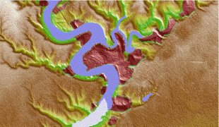
To distinguish Mykolaiv from the much smaller west Ukraine city of Mykolaiv in Lviv Oblast, the latter is sometimes called "Mykolaiv on the Dniester" after the major river that it is situated on, while the former is located on the Southern Bug, another major river, and may also be called "Mykolaiv on the Bug".
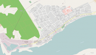
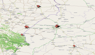
Map - Mykolaiv (Mykolayiv)
Map


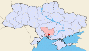
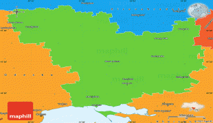

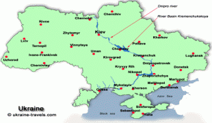
Country - Ukraine
 |
 |
| Flag of Ukraine | |
During the Middle Ages, Ukraine was the site of early Slavic expansion and the area later became a key centre of East Slavic culture under the state of Kievan Rus', which emerged in the 9th century. The state eventually disintegrated into rival regional powers and was ultimately destroyed by the Mongol invasions of the 13th century. The area was then contested, divided, and ruled by a variety of external powers for the next 600 years, including the Polish–Lithuanian Commonwealth, the Austrian Empire, the Ottoman Empire, and the Tsardom of Russia. The Cossack Hetmanate emerged in central Ukraine in the 17th century, but was partitioned between Russia and Poland, and ultimately absorbed by the Russian Empire. Ukrainian nationalism developed, and following the Russian Revolution in 1917, the short-lived Ukrainian People's Republic was formed. The Bolsheviks consolidated control over much of the former empire and established the Ukrainian Soviet Socialist Republic, which became a constituent republic of the Soviet Union when it was formed in 1922. In the early 1930s, millions of Ukrainians died in the Holodomor, a man-made famine. During World War II, Ukraine was devastated by the German occupation.
Currency / Language
| ISO | Currency | Symbol | Significant figures |
|---|---|---|---|
| UAH | Ukrainian hryvnia | â‚´ | 2 |
| ISO | Language |
|---|---|
| HU | Hungarian language |
| PL | Polish language |
| RU | Russian language |
| UK | Ukrainian language |